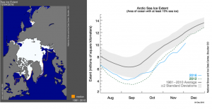
Sea Ice Extent (SIE) index
Sea Ice Extent (SIE) index [mln km2] provides a quick look on changes in sea ice in the Arctic. It provides daily, consistently processed ice extent and concentration from images taken by Nimbus 7 satellite since 1979. The values of the SIE Index are calculated by summing the area of all grid cells 25x25km with 15% or greater ice concentration.
The daily index shows ice extent with an outline of the typical extent for that day based on a 30-year (1981-2010) median. Since 1979 winter Sea Ice Extent in the Arctic has decreased about 3 percent per decade.


 This project (EDU-ARCTIC) has received funding from the European Union’s Horizon 2020 research and innovation programme under grant agreement No 710240. The content of the website is the sole responsibility of the Consortium and it does not represent the opinion of the European Commission, and the Commission is not responsible for any use that might be made of information contained.