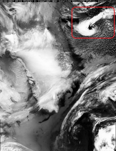
Polar lows
During winter, small cyclones – typically 200 to 600 km in diameter – develop in subarctic regions over areas free of sea ice. The most intense cyclones are called polar lows. These severe storms usually form when polar air is transported over maritime areas. This cold and dry air destabilises the lowest layers of the atmosphere when it arrives over relatively warm waters, creating a polar low.
Short-term forecasting of polar lows remains challenging, because they develop very rapidly, in areas with very few observations. The understanding of the formation of polar lows has been substantially improved with the advent of satellite observations in the late seventies.
Retreating sea ice exposes new ocean areas to extreme weather systems such as polar lows. Climate change could therefore potentially change where and when polar lows will occur in the future.


 This project (EDU-ARCTIC) has received funding from the European Union’s Horizon 2020 research and innovation programme under grant agreement No 710240. The content of the website is the sole responsibility of the Consortium and it does not represent the opinion of the European Commission, and the Commission is not responsible for any use that might be made of information contained.